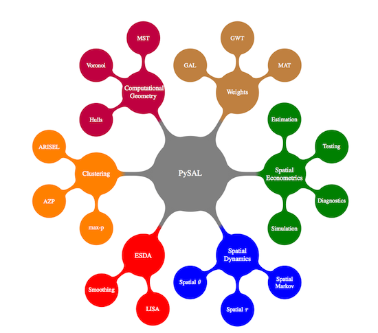
PySAL, the Python spatial analysis library, is an open source cross-platform library for geospatial data science with an emphasis on geospatial vector data written in Python. It supports the development of high level applications for spatial analysis.
github
documentation