Spatial Data
1/31/23
Data’s Place
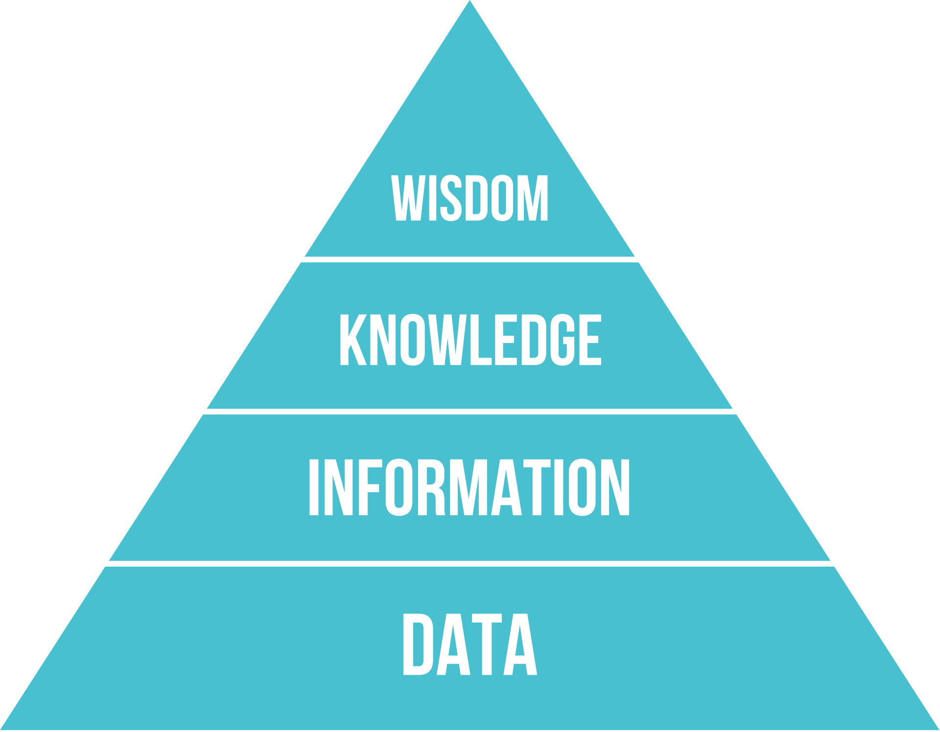
- data: discrete facts, unorganized and lacking context or information
- information: data imbued with meaning - what is in the data
- knowledge: perception of the world seen through information synthesis
- wisdom: “knowing the right things to do”
Geocoding on-line
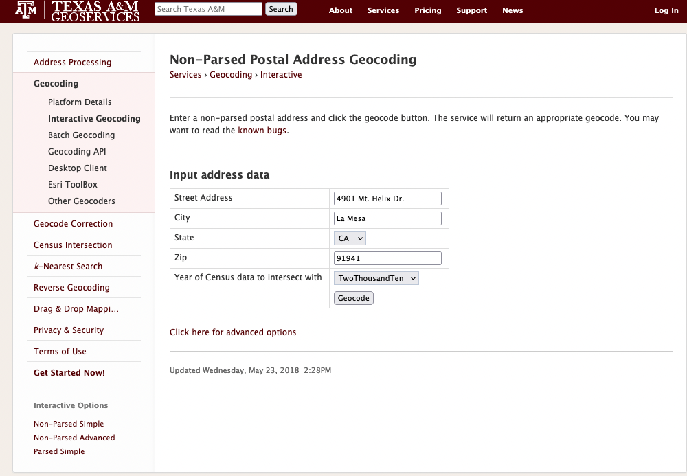
Geocode Input
Geocoding on-line
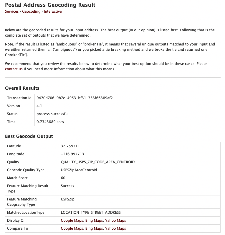
Geocode Output
On the Map?
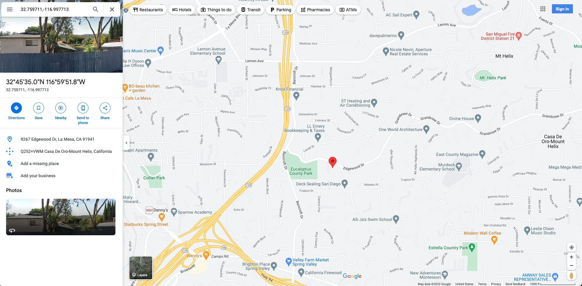
Map of Geocode Output
On the Map?
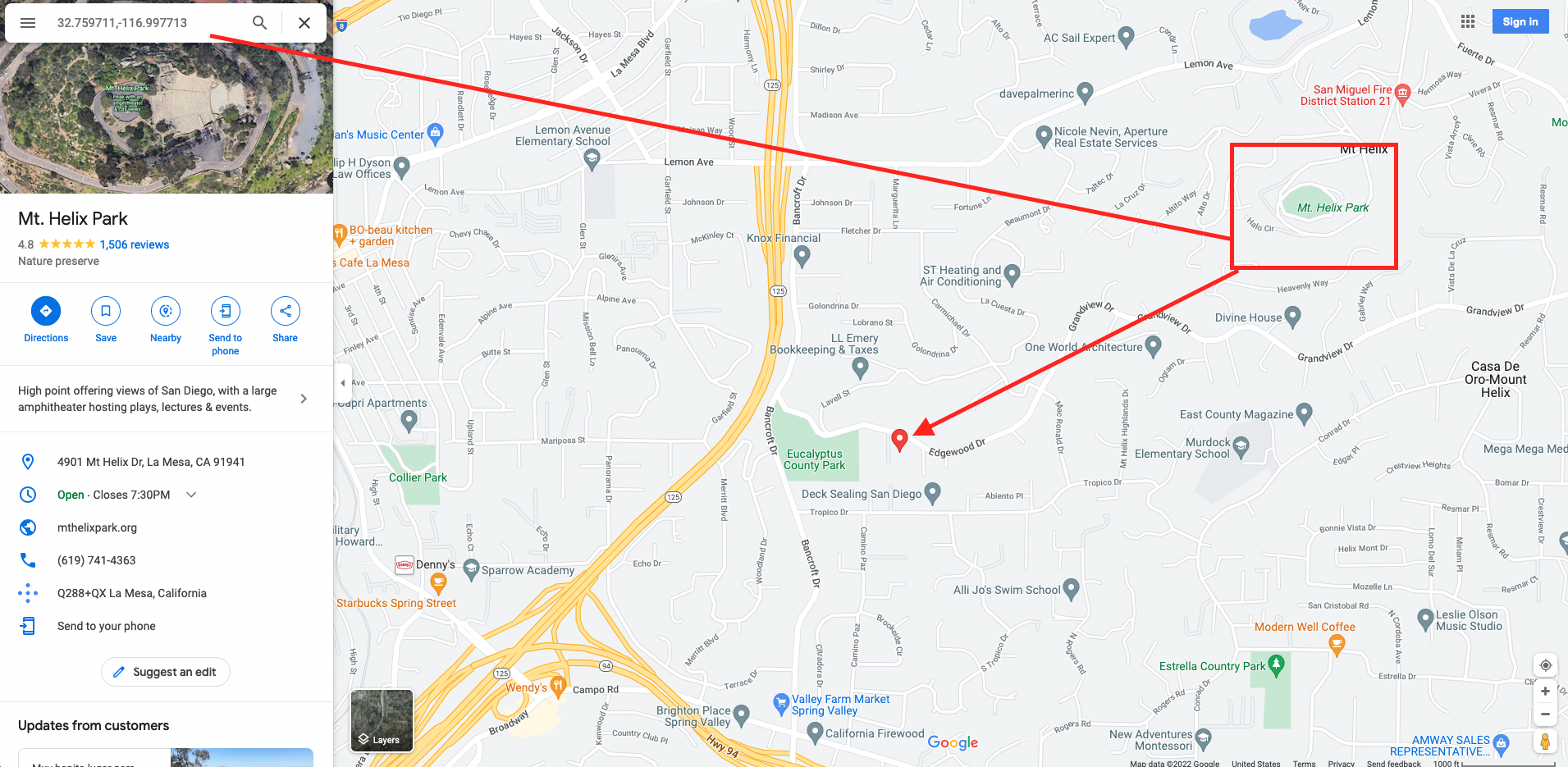
Errors in Geocode Output
MAUP Zonation Problem
http://en.wikipedia.org/wiki/Modifiable_areal_unit_problem
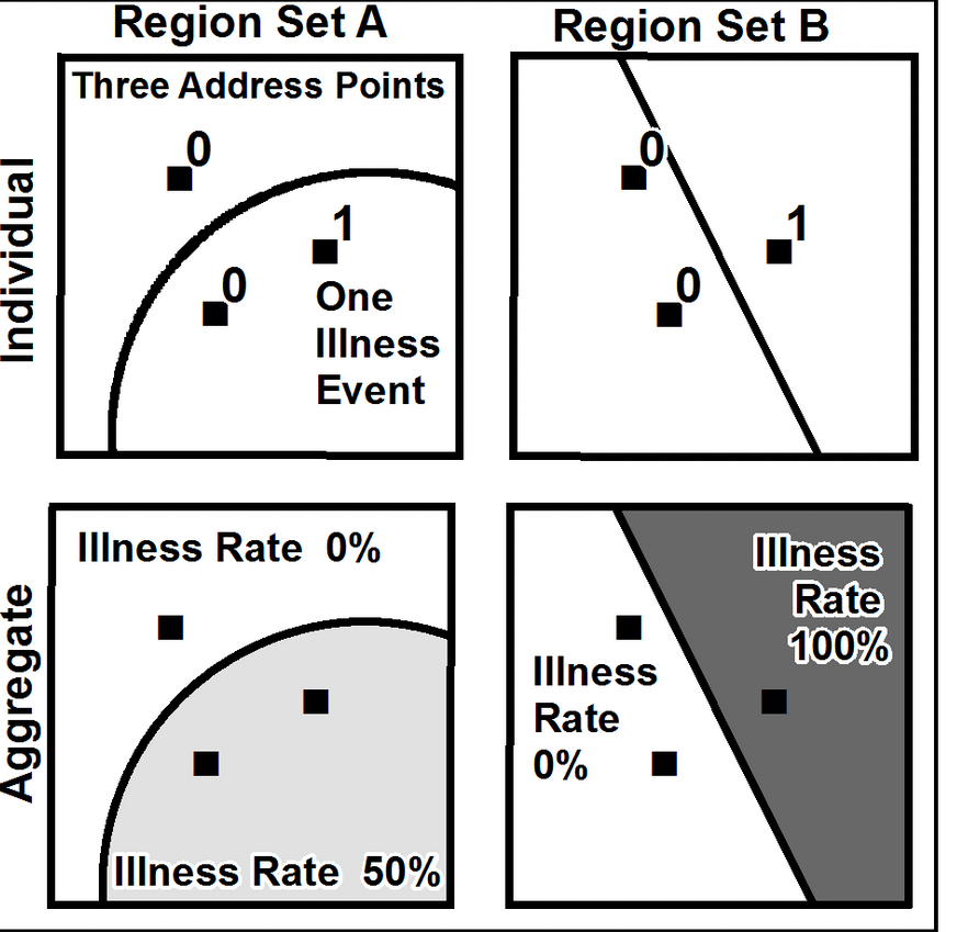
MAUP Aggregation Problem
- True rate = 1/3 = 33%
- A’s rate = (0 +1/2) /2 = 25%
- A’s weighted rate = 1/3 * 0 + 2/3 * 50 = 33%
- B’s rate = (0 + 100) /2 = 50%
- B’s weighted rate = 2/3 * 0 + 1/3 * 100 = 33%
Point Pattern Analysis: Quadrat Methods
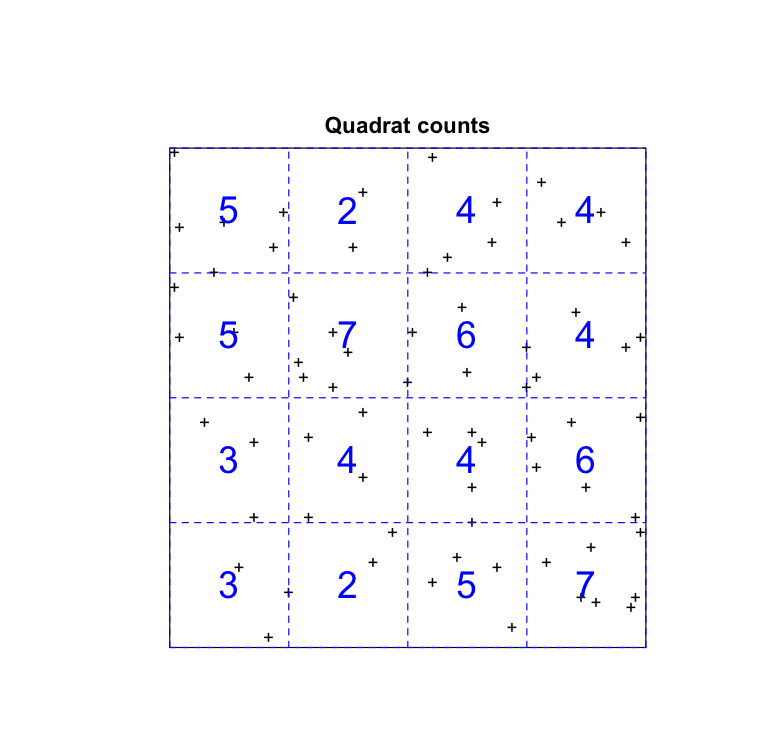
Quadrat Analysis
Point Pattern Analysis: Distance Based Methods
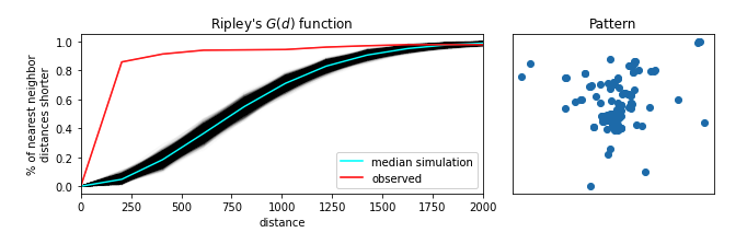
Distance Distributions
Lattice Data: County Per Capita Incomes
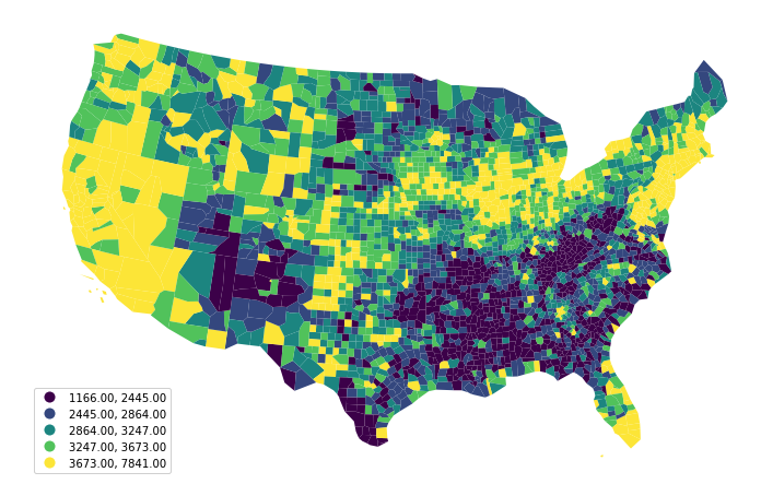
1969
Geostatistical Data: Monitoring Sites
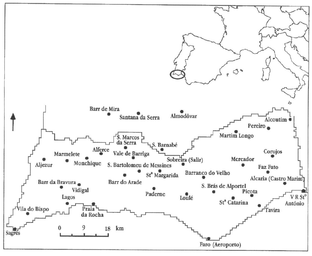
Sites
Geostatistical Data: Surface Reconstruction
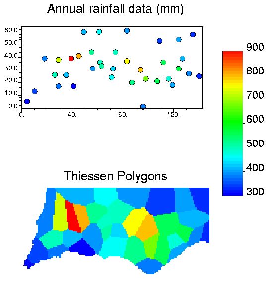
Tessellation
Geostatistical Data: Surface Reconstruction
Interpolation
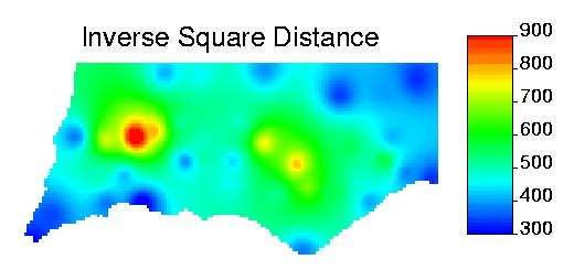
Geostatistical Data: Surface Reconstruction
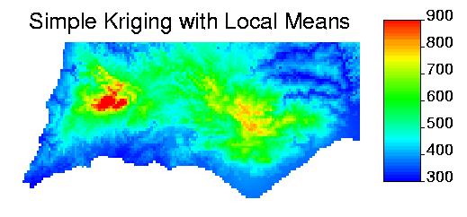
Kriging
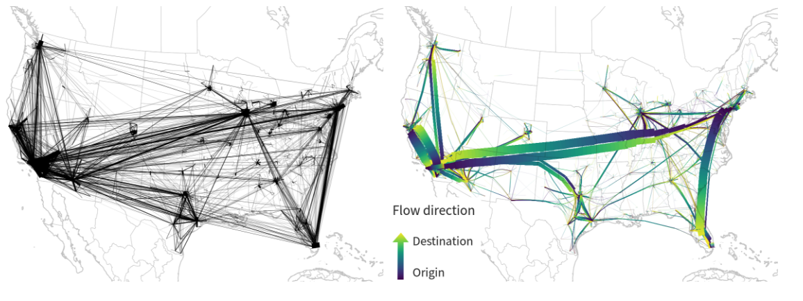
Network Data
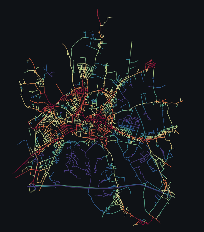
Flow Data